From July 11 to July 19, 2024, under the guidance of Professors Yan Yanyun, Huang Guanghui, Lu Lei, Cao Bo, Wang Xiaoyan, Cui Xia, Zhu Gaofeng, and Zou Songbing, students from the 2021 Geographic Information Science Class of the School of Earth and Environmental Sciences at Lanzhou University embarked on a 9-day 3S Integrated Field Practice, departing from the Yuzhong Campus.
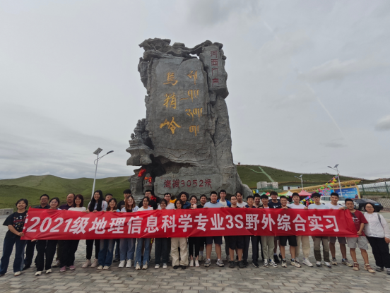
Group Photo of the 3S Integrated Field Practice
On July 12 and 13, the group visited the Heihe Remote Sensing Experimental Research Station of the Chinese Academy of Sciences, gaining in-depth exposure to advanced remote sensing technology. Engineer Ren Zhiguo introduced the station's setup and subsequently led the teachers and students to visit the Daman Remote Sensing Observation Station, Huazhaizi Observation Station, and the Radiation Calibration Laboratory within the station. They observed the deployment of sensor nodes and conducted field investigations into the advanced remote sensing techniques employed at the site. Engineer Ren also provided a detailed explanation of wireless sensor networks, aerial remote sensing, calibration, and validation experiments, and discussed the multi-scale observation experiments on non-uniform underlying surface evapotranspiration from a temporal perspective. Accompanying Professor Huang Guanghui supplemented this knowledge with insights from observational and policy perspectives. This field investigation deeply impressed upon the students the importance and value of instrumentation technology in Geographic Information Science, inspiring a strong sense of responsibility and mission within them.
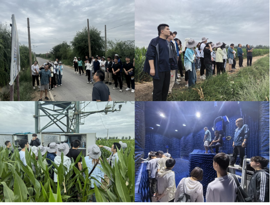
Chinese Academy of Sciences Heihe Remote Sensing Experimental Research Station
On July 14, under light rain, the team embarked on a day of exploration under the theme "Morning in Golden Zhangye, Afternoon in Silver Wuwei." At the Zhangye National Wetland Park, Engineer Ren Zhiguo led the students to a 10-meter observation tower, explaining its significance and design features, with a special focus on the instruments used for methane analysis. Professor Nian Yanyun supplemented this by pointing out that the condition of wetland vegetation can be an indicator of wetland utilization, guiding students to reflect on the relationship between policy and ecology. The students also visited the Wetland Museum.
In the afternoon, the team arrived at the Shiyang River Station of Lanzhou University in Wuwei City. Professor Cao Bo, the station head, introduced the basic situation of the station, including its purpose and significance, the general overview of the field station, existing observation systems and achievements, as well as the station’s research profile and talent development. The students showed great interest in the geographical environment, research focus, and outcomes of the station, demonstrating a strong enthusiasm for Geographic Information Science. In the evening, the students presented their group research findings, with teachers providing evaluations and suggestions to enhance teamwork and deepen their understanding of geographical knowledge.
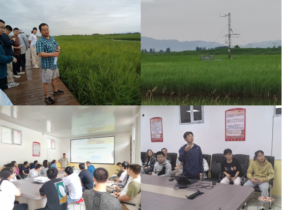
Zhangye National Wetland Park and Lanzhou University Shiyang River Station
From July 15 to 18, the team continued their journey at the Liancheng Forest Ecosystem Field Scientific Observation and Research Station in Gansu, experiencing a new chapter in their field practice. The team visited various observation sites, including Quanwan and the nursery observation site, where Professor Nian Yanyun gave a brief introduction to the environment and arranged for the field measurements. The observation equipment included three types of drones: DJI M300 equipped with Zenmuse L1 LiDAR and MS600pro multispectral camera for point cloud data and canopy height models; DJI Mavic 3 Pro for orthophotos and oblique photography; and the Phantom 4 Multispectral for 3D flight. Additionally, handheld LiDAR devices were used in conjunction with drones to obtain complete 3D data. The students were divided into four groups, where they systematically learned and operated the observation instruments, ultimately acquiring orthophotos, point cloud data, and canopy height models from the two observation sites.
Professor Cui Xia provided a detailed explanation of leaf area index (LAI) measurement instruments, progressing from plant physiology to operational methods. The students learned the process of calculating LAI and practiced measuring it in selected plots under Professor Cui's guidance. Professor Wang Xiaoyan explained the principles and operation of spectrometers in detail, guiding students to operate the equipment and measure observable features in the field, analyze their spectral curves, and determine the absorption and reflection of different wavelengths, thereby experiencing the integration of theoretical knowledge with practical application.
After acquiring a large amount of field data, the students, under the guidance of Professor Yan and graduate student mentors, used DJI Terra, LIDAR360, Pix4D, and commonly used Geographic Information Science software such as ArcGIS and ENVI in the Liancheng Station’s fourth-floor conference room to learn how to process multispectral point cloud data, 3D data, and orthophotos, engaging in discussions to address any problems encountered.
In addition to observation and mapping, Professor Nian Yanyun led the students to a nearby nursery experimental site, introducing the research approach and its integration with ecological studies. This experimental site employs a controlled variable method to determine the effects of meteorological factors such as temperature and humidity on the growth of Qinghai spruce. Professor Yan’s clear and detailed explanations broadened the students' professional horizons and cultivated their ability to think across multiple disciplines.
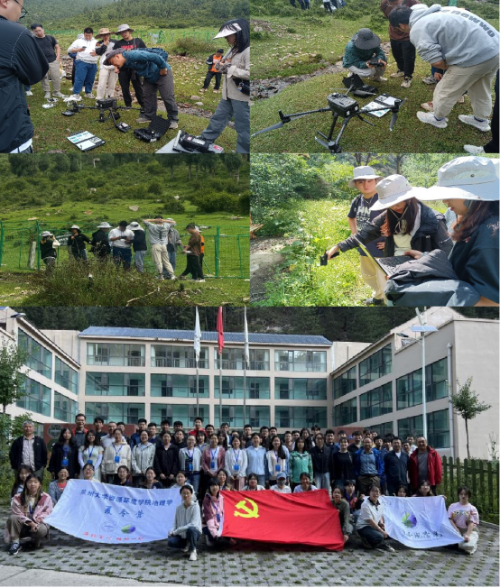
Liancheng Forest Ecosystem Field Scientific Observation and Research Station
On July 19, the team began their return journey, stopping at their final destination: the Gansu Provincial Basic Geographic Information Center. Director Li Chourong provided a comprehensive overview of the center’s development and functions, with a particular emphasis on the advancement of new foundational surveying and 3D real-world technology. Staff members from three departments gave detailed presentations on remote sensing applications, 3D real-world technology, and map services. The students gained a deeper understanding of the center's work, experienced the practical application of geographic information technology, and appreciated the integration of professional knowledge with its applications.
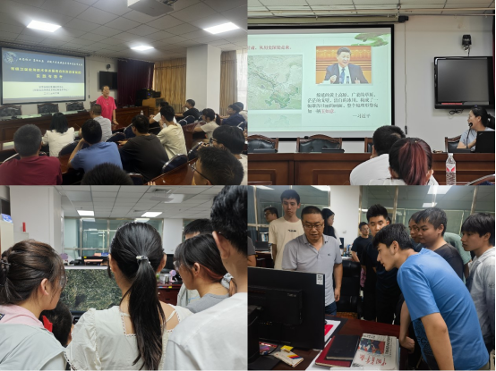
Gansu Provincial Basic Geographic Information Center
With this, the 2021 Geographic Information Science students successfully concluded their 2024 summer field practice. This journey was full of challenges and rewards. Throughout the practice, the students overcame various difficulties posed by distance and environmental conditions, showing courage as they explored diverse terrains and experienced different climates. They faced challenges head-on and pushed forward.
This field practice involved site visits to multiple locations, providing in-depth understanding of the geographical environments of different regions and the applications of Geographic Information Science. By integrating on-site practice with theoretical knowledge, the students deepened their understanding of Geographic Information Science, familiarized themselves with the use of professional instruments, and mastered practical skills, laying a solid foundation for future studies and career development.
This field practice will become a valuable memory in the students’ academic journey, paving the way for future learning and career growth. The 2021 Geographic Information Science students will continue to strive, continuously enhancing their professional skills, and making greater contributions to the development of Geographic Information Science.