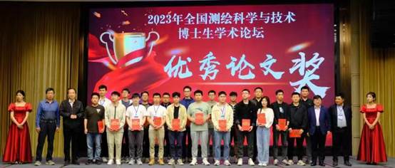
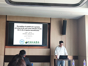
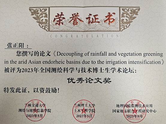
Recently, at the 2023 National Doctoral Academic Forum on Surveying and Mapping Science and Technology and the Working meeting of the Surveying and Mapping Discipline Evaluation Group of the Degree Committee of The State Council held in Lanzhou, Zhang Zhengyang, the 2020 master student majoring in Cartography and Geographic Information System of our college, gave a speech on the topic of "Photogrammetry and Remote Sensing" titled:Decoupling of rainfall and vegetation greening in the arid Asian endorheic basins due to the irrigation intensification oral report.After evaluation by the academic Committee of the Conference, the report won the "Excellent Paper Award" of the Forum as the first prize in the special topic (there were 20 winners in the conference).Based on long-series multi-source satellite remote sensing data, this report studied the vegetation change trend and potential hydrometeorological driving factors in the Asian inland river basin, the core region of the Belt and Road Initiative, in the past 20 years, and found that the vegetation change pattern dominated by TWSA (land water reserve change) in the arid region was caused by the rapid development of irrigated agriculture.The report fully shows the application potential of satellite remote sensing big data in the sustainable development of arid areas, and reflects the academic ability and research potential of our graduate students.

Zhang Zhengyang was admitted to our college in 2020 to pursue a master degree in Cartography and Geographic Information Systems, under the supervision of Junior Researcher Ma Xuanlong. Since enrollment, Zhang Zhengyang has published two first-author papers in SCI journals and several collaborative papers (with one first-author SCI paper under review currently). Zhang Zhengyang has also participated in research projects, including the National Natural Science Foundation project, and has received multiple academic awards successively, such as the "Innovation Star" Excellent Graduate Research Project from the Gansu Provincial Department of Education (awarded as excellent), Outstanding Paper at the Graduate Academic Annual Conference of College of Earth and Environmental Sciences and the "Excellent Graduate" award from Lanzhou University. With support from the research group,Zhang Zhengyang has attended and delivered oral reports at mainstream academic conferences in China, including the National Space and Earth Science Academic Forum, China Ecology Conference, Fengyun Meteorological Satellite User Conference, etc.


Context of the News
The 2023 National Surveying and Mapping Science and Technology Doctoral Academic Forum, along with the Working Meeting of the Surveying and Mapping Discipline Evaluation Group of the Academic Degrees Committee of the State Council, is jointly organized by Lanzhou Jiaotong University, Lanzhou University of Technology and the National-Local Joint Engineering Research Center for Geographical National Conditions Monitoring and Technological Application. This event aims to provide an academic platform for doctoral students in the field of surveying and mapping science and technology to engage in mutual exchange and communication.
The forum consisted of four main topics: Geodesy and Surveying Engineering, Photogrammetry and Remote Sensing, Cartography and Geographic Information Engineering. We received over ninety submissions of excellent papers for consideration. After a thorough evaluation by experts from the Journal of Surveying and Mapping and the organizing institutions, more than thirty papers were selected as finalists. Ultimately, the Academic Committee of the conference reviewed and awarded the top twenty papers as the Outstanding Paper Awards.